Smart Farming from Space: How ADB’s Study Modernizes Rice Monitoring in Vietnam
The ADB, NSO of Vietnam, and JAXA used advanced satellite remote sensing and area frame surveys to accurately map rice fields in An Giang Province, revolutionizing agricultural data collection. Their hybrid, cost-efficient approach offers Viet Nam faster and more reliable crop statistics, strengthening food security and resilience against climate risks.
The Asian Development Bank (ADB), together with the National Statistics Office (NSO) of Vietnam and the Japan Aerospace Exploration Agency (JAXA), has pioneered a study titled Mapping Rice in Vietnam: Estimating Rice Area Using Remote Sensing and Area Frame Survey Methods in An Giang Province. Supported by the Japan Fund for Prosperous and Resilient Asia and the Pacific (JFPR), this collaboration bridges space technology and agricultural statistics to redefine how Vietnam measures its most vital crop. Conducted in An Giang Province, a major rice-producing hub, the research introduces a hybrid method combining satellite remote sensing with probability-based field surveys, offering a faster, more accurate, and cost-effective alternative to traditional reporting.
From Clipboards to Satellites
Vietnam's long-standing approach to rice area estimation has relied heavily on administrative reports from local officials. Though comprehensive, this system is often slow and inconsistent due to observer bias, weather disruptions, and logistical challenges. The ADB-led study offers a breakthrough, pairing field-based "ground truth" surveys with data from satellites like JAXA's ALOS-2 and the European Space Agency's Sentinel-2. The integration of such remote sensing tools marks a shift from subjective visual estimates to objective, science-based data collection, transforming how national statistics are compiled.
Mapping Rice with Machine Learning
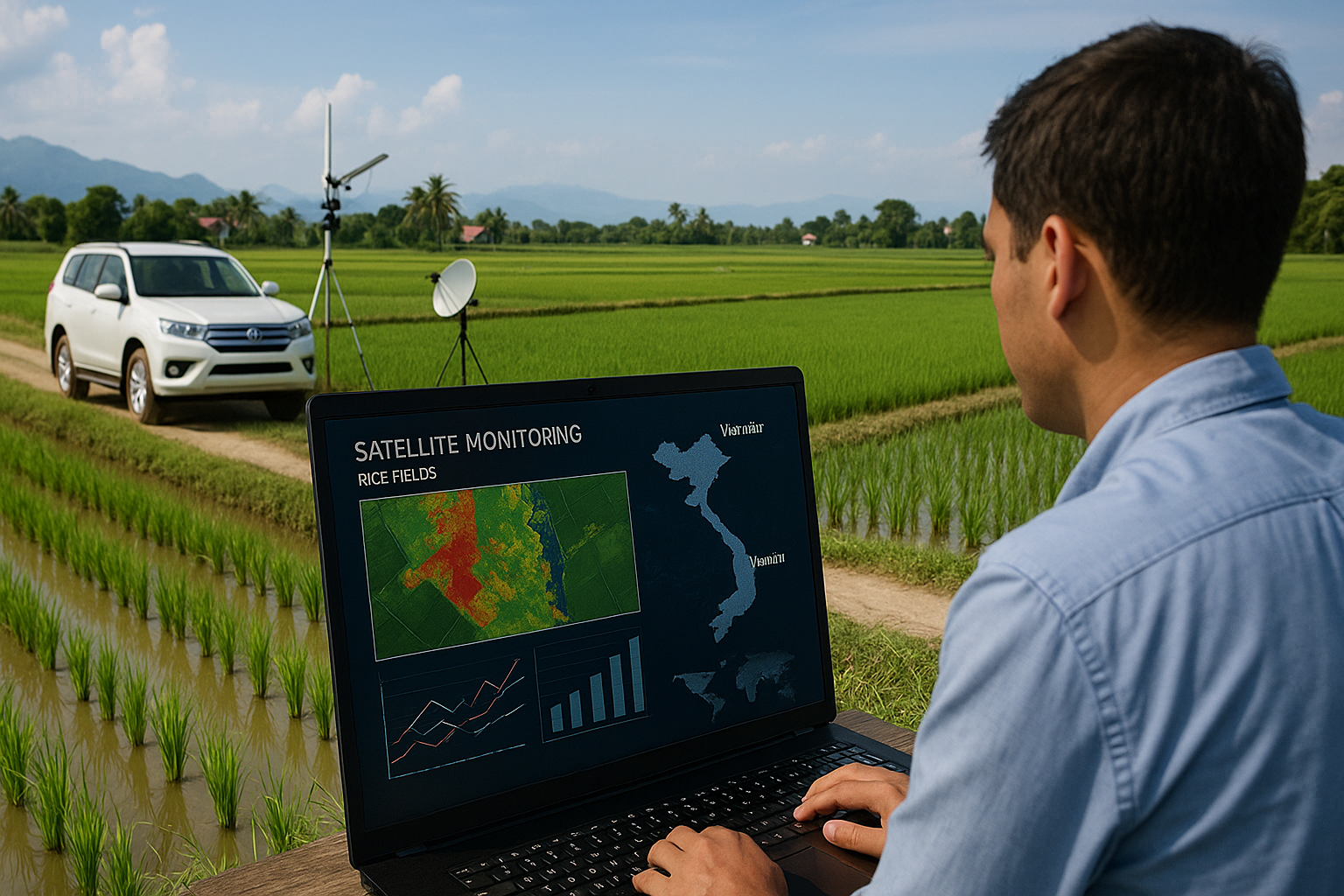
At the heart of this study lies the International Asian Harvest mOnitoring System for Rice (INAHOR), developed by JAXA. Operated through the Google Earth Engine (GEE), INAHOR processes radar and optical satellite images to classify land cover and identify rice fields automatically. ADB and NSO teams collected 272 field samples across 34 one-square-kilometer grids during the 2024 summer–autumn rice season, recording GPS coordinates, photographs, and field observations. These samples were used to train INAHOR's Random Forest algorithm, which analyzed spectral indices such as the Normalized Difference Vegetation Index (NDVI) and Normalized Difference Water Index (NDWI). The model achieved 95.3% accuracy and a kappa coefficient of 0.91, demonstrating exceptional precision in distinguishing rice from non-rice areas.
Results that Redefine Accuracy
The study tested three estimation techniques: the expansion estimator, the ratio estimator, and an adjusted ratio estimator that corrected for mismatched data segments. Results were remarkably consistent, around 2,500 square kilometers of rice were identified in An Giang Province, accounting for roughly 71% of its total land area. This aligns closely with INAHOR's satellite-based estimate of 2,500.1 km² and the adjusted ratio estimator's 2,501.1 km². Interestingly, both exceeded the NSO's administrative report of 2,284.8 km², suggesting that conventional systems may underreport cultivated areas due to delayed updates or localized errors. Uncertainty mapping further revealed minor discrepancies in mixed-cropping zones like Chợ Mới District, where rice fields intermingle with other crops.
Building a Digital Future for Farming
Beyond technical success, the report envisions a sustainable future for agricultural monitoring. Remote sensing and area-frame surveys, it argues, should complement, not replace, traditional systems. Together, they can deliver timely, granular, and verifiable data at lower cost. Ground surveys that once took months can now be completed within a week using small teams and open-source tools like GEE and QGIS. The study recommends institutionalizing ground-truth surveys as part of routine statistical work, ensuring coordination between GIS and agricultural units for synchronized data collection.
The research also identifies challenges such as inconsistent crop growth stages and cloud interference in optical imagery. To overcome these, it calls for multi-temporal data collection and greater integration of radar imagery. Yet despite these hurdles, the An Giang pilot sets a powerful precedent: that satellite-driven, machine-learning-assisted monitoring can become a cornerstone of agricultural governance in developing economies.
In essence, this collaboration between ADB, NSO, and JAXA showcases how technology and statistical science can work hand in hand to transform rural data systems. By making rice area estimation more transparent, efficient, and responsive, Vietnam is moving toward a new era of digital agriculture, one that empowers policymakers to act swiftly against food insecurity and climate risks. The study is more than a technical achievement; it is a vision of how evidence-based, data-driven agriculture can help sustain prosperity in a changing world.
- FIRST PUBLISHED IN:
- Devdiscourse
ALSO READ
-
India's Broadband Surge: Nearing the Billion-User Milestone
-
From Growth to Equity: ADB Urges China to Tackle Inequality Through Structural Reforms
-
ADB Approves $100 Million Loan to Boost STEM Education in Uzbekistan
-
ADB and Japan FSA Partner to Strengthen Financial Systems Across Asia-Pacific
-
ADB and World Bank Sign $3 Billion Risk-Sharing Deal to Boost Lending Capacity